
Mount Flora: An Excellent Intro Colorado 13er
- Mar 11, 2025
- 3 min read
Updated: Apr 3, 2025

Sure, Mount Flora isn’t a 14er, but at 13,129 feet (just shy of 4,000 meters for the metric-minded), it’s still plenty high. Sometimes, it's better to start a little smaller and work your way up—and Mount Flora is the perfect place for that. This Class 1 hike keeps you above the treeline for most of the journey, offering incredible views with a solid payoff for the effort. After this one, you’ll be itching to tackle more high peaks.
Trail Info
Trailhead Name | Mount Flora Trail |
Distance | 6.4 miles / 10.3 km (out and back) |
Estimated time | 3-5 hours |
Elevation gain | 1,800 ft / 550 m |
Highest point | 13,129 ft / 4,001 m (Mount Flora) |
Permits / fees | None |
Parking | Paved lot |
Toilets? | Yes |
Dog friendly? | Yes |
Know before you go
This is a Colorado 13er, so take proper precautions. There are plenty of resources out there for how to minimize risk when summiting these high peaks. Start early, keep an eye on the weather, and aim to be below treeline before noon.
Other trails nearby
Distance: 5.4 miles (8.7 km)
Elevation gain: 1,400 ft (425 m)
Details: Just up the road and tops out around 12,050 ft (3,670 m). While those high elevation views don't last quite as long, the route offers beautiful foliage and a scenic river.
Distance: 7.4 miles (11.9 km)
Elevation gain: 1,850 ft (560 m)
Details: Literally right across the street and is a nice burner that tops out at 12,529 ft (3,818 m) with rewarding ridgeline views.
The Trail

The trailhead begins at the Berthoud Pass parking area. This lot is fairly large, but on a summer weekend, it can fill up quickly. I've seen people park along the highway, but if you want to secure a spot, arrive early—or opt for a weekday hike.
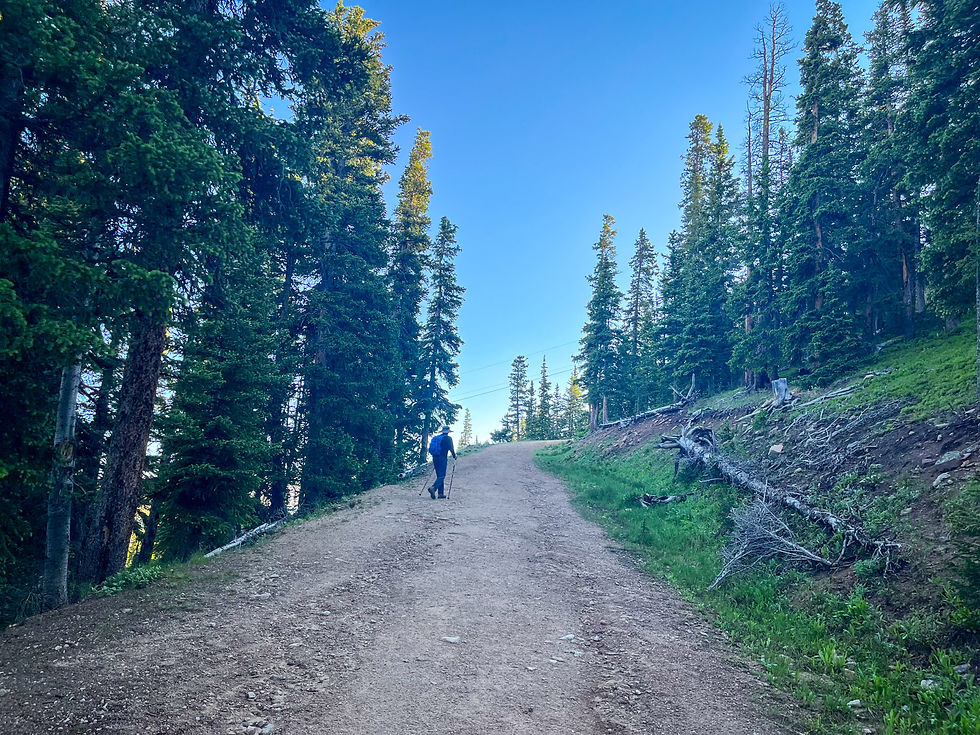
The hike begins "in the trees" along a wide, road-like path. Berthoud Pass is already at 11,307 feet (3,446m), so you're nearly at treeline right from the start.

Taking a moment to check on our progress (and my car!). Just across the road is another great hike—Stanley Mountain.

One of the challenges of starting at high elevation is that the altitude hits you fast. I was definitely huffing and puffing by this point—great excuse to soak in the views! Hard to tell, but straight ahead is Winter Park Ski Resort. Looks a little different without snow!

There's essentially zero technical challenges on this hike. Some reports call it a Class 2, but it really isn’t. There’s no scrambling, and the trickiest section is this narrow stretch—still plenty of room, and no sheer drop-offs to worry about.

Around 12,000 feet, you’ll reach a junction. Right leads to Colorado Mines Peak, while left keeps you on the trail to Mount Flora. It's also a perfect spot to take in the view—looking south over Blue Lake. Just out of the frame to the right, you could spot Grays and Torreys Peaks, one of the most popular 14er combos near Denver.
Almost there! I love looking back at the ground we’ve covered, with all those peaks stretching into the background.

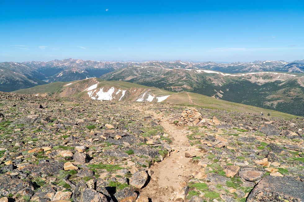
Made it! Mount Flora’s summit area is broad and open, without a distinct peak. I always think of these east-facing views toward Ethel and Byron Lakes as the true summit

A wider look at the summit area—rocky and expansive.

There's some more action if you're feeling saucy. The ridgeline continues on and there's three additional 13ers you can summit (Eva, Parry, and Bancroft). But a 13+ mile nearly 5k feet in elevation feels a bit more than the Doctor ordered today.
And now, one last look at that stunning view on the hike down.
SS Reflections
After summiting a few 14ers, tackling a 13er initially felt like a step backward. But the moment I got above treeline, I realized how wrong that mindset was. The views are just as breathtaking, and the sense of awe just as powerful. You might not get to check off a big milestone, but I guarantee the experience—and the satisfaction—will be just as rewarding.
Other helpful resources
Fat Man Little Trail's post about this hike


