
Stanley Mountain: 12'er with Epic Alpine Views near Berthoud Pass
- Jul 17, 2025
- 3 min read
Updated: Jul 18, 2025

It’s not a 14’er (or even a 13’er). But don’t let the numbers fool you, Stanley Mountain more than delivers. Nearly the entire hike is above treeline, immersing you in expansive views of the Central Rockies with every step. If you’re looking for a high-alpine adventure with minimal crowds or chaos, this is a perfect pick.
Trail Info
Trailhead Name | Berthoud Pass West/Mount Nystrom Trail |
Distance | 7.7 miles / 12.4 km (out and back) |
Estimated time | 4-5 hours |
Elevation gain | 1,750 ft / 530 m |
Highest point | 12,521 ft / 3,816 m (Stanley Mountain) |
Permits / fees | None |
Parking | Paved lot |
Toilets? | Yes |
Dog friendly? | Yes |
Know before you go
You're in high alpine territory. This trail might not be a 14’er, but the exposure and elevation demand respect. Bring layers, watch the weather, and be off the summit early.
Altitude is a factor here. At over 12,500 ft, this hike can sneak up on flatlanders. Hydrate, pace yourself, and don’t be afraid to rest.
There's an alternate summit approach. The second approach travels via the Henderson Mine. While it achieves the same objective, it seems as though the Berthoud Pass route (this post), may be more enjoyable.
Other trails nearby
Distance: 6.4 miles (10.3 km) out and back
Elevation gain: 1,800 ft (550 m) gain
Details: Leaves from the same trailhead and tops out above 13,000 ft. Expect alpine lakes and sweeping views
Distance: 5.4 miles (8.7 km)
Elevation gain: 1,400 ft (425 m)
Details: Just up the road. Slightly lower elevation than Stanley, but packed with scenic river views and seasonal foliage
The Trail

After parking at Berthoud Pass, cross Highway 40 (carefully!) to reach the Berthoud West trailhead.

The hike begins on a mellow path through the forest, with gentle switchbacks easing you into the climb. The summit area, visible as the leftmost high point, is still far off.

Enjoy the time in the trees, because it won’t last long. Soon you’ll break through the treeline and stay above it for the rest of the hike.
And with the beauty comes the burn. The steepest stretch of the hike is this series of switchbacks that get your legs and lungs working. Without them, this section would be a real grind.

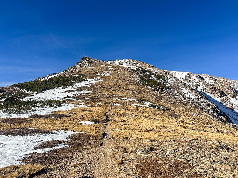
At around 12,000 ft, you’ll crest onto the ridge. From here on out, the terrain is more forgiving, gently rolling toward the summit.

This is where Stanley shines. Endless views of surrounding peaks and valleys, with that big alpine energy all around you.

The summit itself may sneak up on you. It's basically a pile of rocks barely higher than the ridgeline. Bring a map if you want to confirm you've tagged the true high point.

Once there, soak in the views. Here's a look back toward the route you came up.

And here’s a shot of the alternate approach from Henderson Mine. hard to beat that snowy backdrop.

It’s a killer trail in an incredibly scenic stretch of Colorado.
SS Reflections
I’m a sucker for a ridge hike that stays above treeline. Stanley Mountain checks all the boxes: huge views, minimal crowds, and a good workout without being a sufferfest. It’s the kind of summit that gives you everything you want from a high-altitude hike, without requiring a 5 a.m. start or a week of acclimation. An underrated gem that deserves more love.
Other helpful resources
Van life by design's post and pictures of this hike


