
Mount Audubon: A Stunning 13er in Brainard Lake
- Jul 20, 2025
- 3 min read
Brainard Lake Recreation Area is full of gorgeous trails, many of which take you right up to serene alpine lakes. But if peakbagging runs through your veins and you're chasing that high-altitude thrill, Mount Audubon delivers. It’s a rewarding challenge, with big views and that unbeatable feeling of standing on a summit.
Trail Info
Trailhead Name | Mount Audubon Trail |
Distance | 7.6 miles / 12.2 km (out and back) |
Estimated time | 3-5 hours |
Elevation gain | 2,700 ft / 820 m |
Highest point | 13,217 ft / 4,029 m (Audubon) |
Permits / fees | Yes ($2 for parking reservation, $16 for day access if you don't have National Parks Pass) |
Parking | Paved lot |
Toilets? | Yes |
Dog friendly? | Yes |
Know before you go
Reservations are required at Brainard Lake from June to October. Make sure to grab a timed entry slot, ideally for the Mitchell Lake Trailhead. (Note, you can still access this trail from the other parking locations with a little extra distance
The trail gets rocky near the top. While it never exceeds an easy Class 2, you’ll want footwear that protects your ankles as there’s a good chance you’ll feel them rolling around a bit.
Other trails nearby
Distance: 6.6 miles (10.6 km) out and back
Elevation gain: 650 ft (200 m) gain
Details: A mellow, scenic hike that winds past waterfalls and wildflowers before reaching the breathtaking shores of Lake Isabelle
Distance: 5.6 miles (9 km) out and back
Elevation gain: 1000 ft (300 m) gain
Details: This trail offers a beautiful alpine lake destination with a gradual incline through pine forest and meadows
The Trail
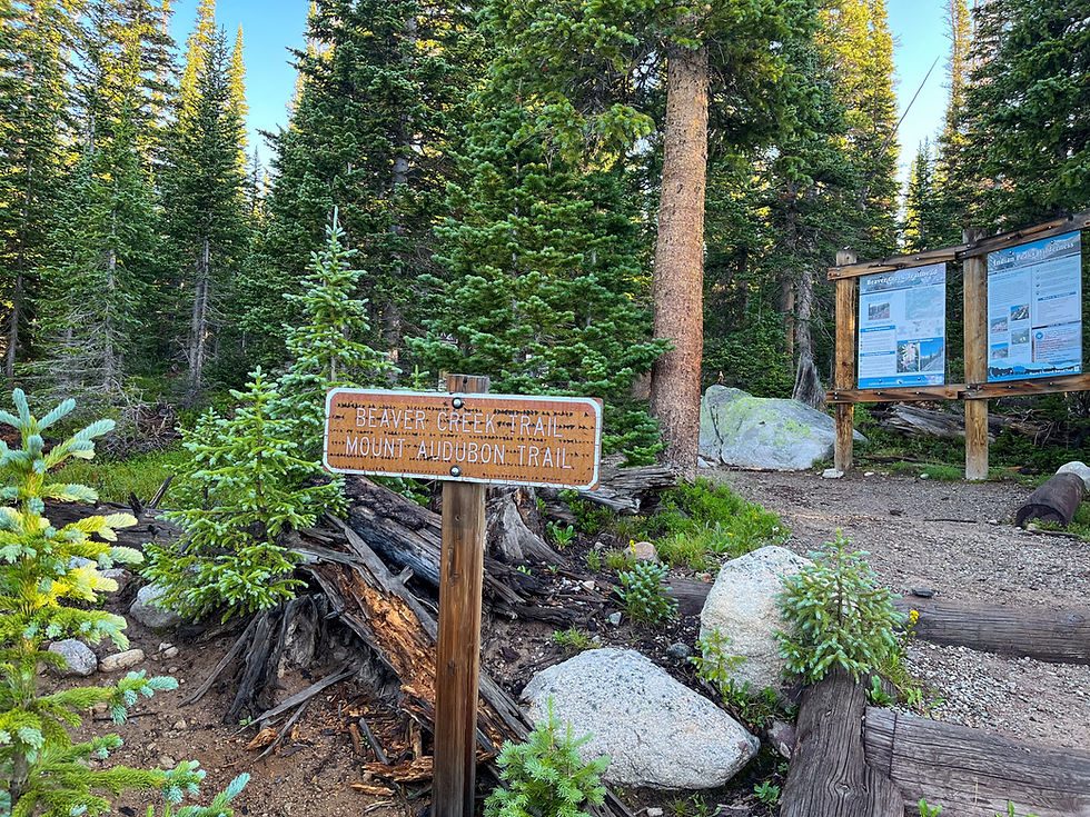
The ideal starting point is the Mitchell Lake Trailhead, though you could also connect from Brainard Lake or Long Lake with a short approach hike. Note, you will head to the Beaver Creek Trail (not the Mitchell Lake Trail) to begin the trek to Mount Audubon.
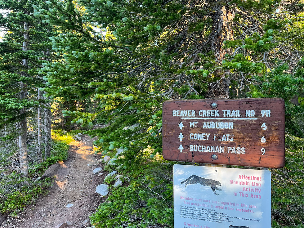
And we’re off! Always a good sign when your trailhead warns about mountain lions. But honestly, if you spot one, count yourself lucky. Sightings are incredibly rare, and attacks are virtually nonexistent.
(Fun fact: In Colorado, there have been fewer than a dozen fatal mountain lion attacks recorded since 1900.)

The trail begins under tree cover, offering a few intermittent mountain peeks.
Before long, you’ll break through treeline and stay above it for the rest of the hike.
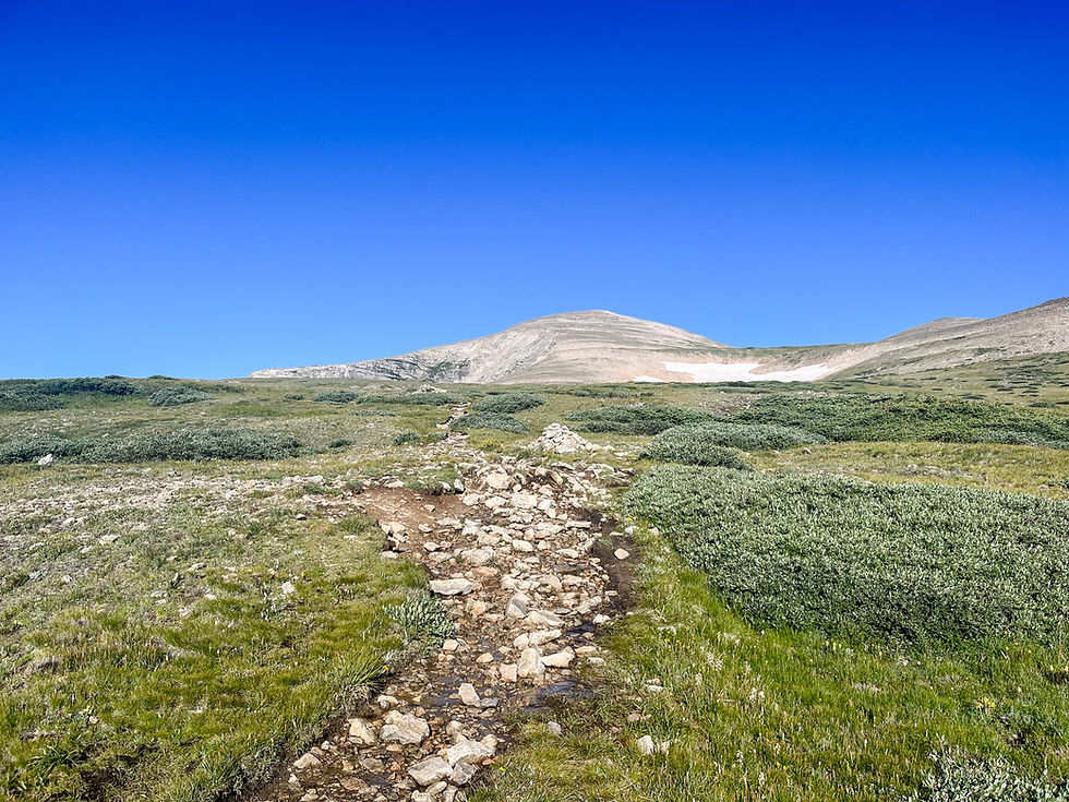
This is a steady uphill grind. There aren’t many switchbacks; the ascent is more of a slow, determined march upward.
There’s only one junction to be aware of, about 1.7 miles in. Stay left to continue toward the Audubon summit,
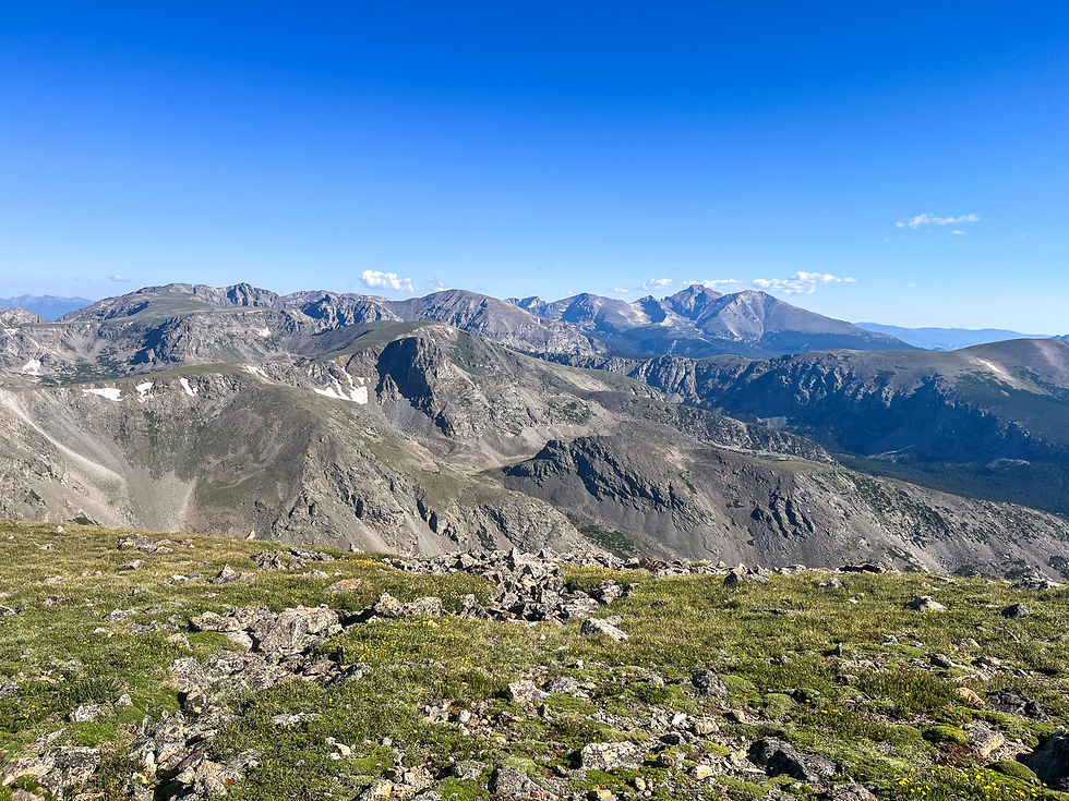
A short set of switchbacks follows the junction, then the trail bends westward. Take a moment to glance right. On a clear day, you’ll see some standout peaks from the Indian Peaks Wilderness.

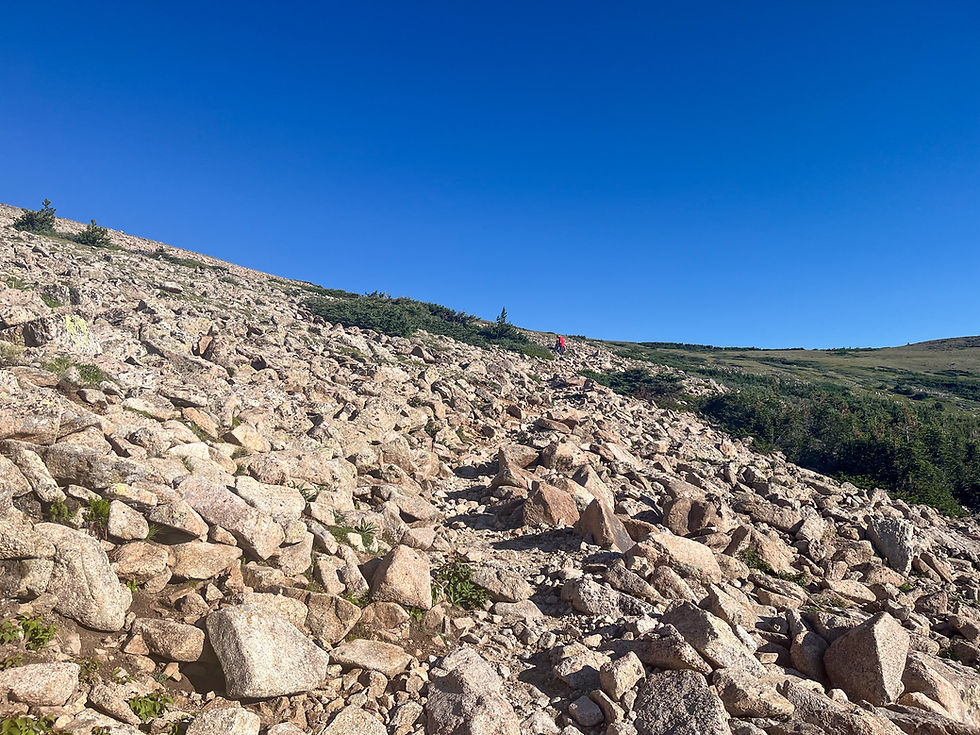
And now for the final stretch: the summit push. This is the toughest part of the hike as it's steeper and much rockier than the rest.
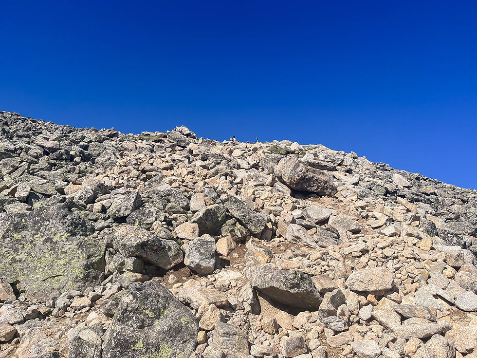
Routefinding isn’t too tricky. A worn path is usually visible, but even if you lose it, just keep heading up. I occasionally used my hands for balance, which is why I’d classify this section as an easy Class 2.
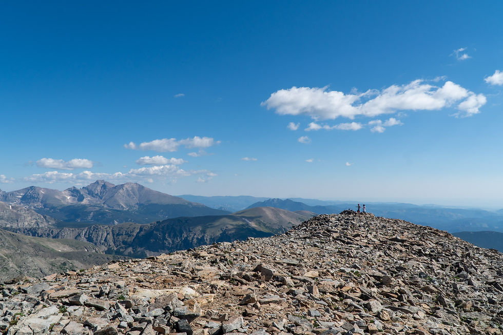
And there it is—13,217 feet above sea level! Audubon has a long, broad summit. There’s a slightly higher point at one end, but mostly it’s a wide-open place to roam, relax, and take it all in.
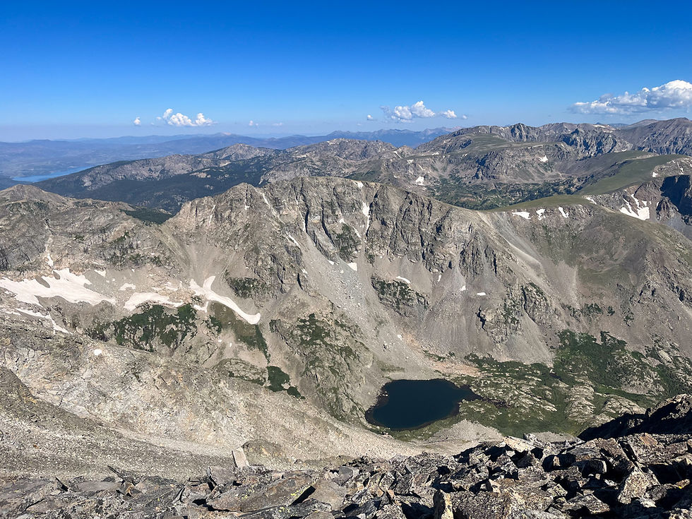
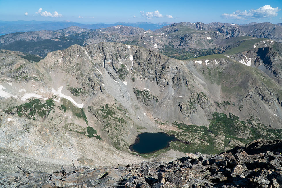
It’s worth wandering a bit. You’ll find some great perspectives, like this one looking down on Coney Lake.
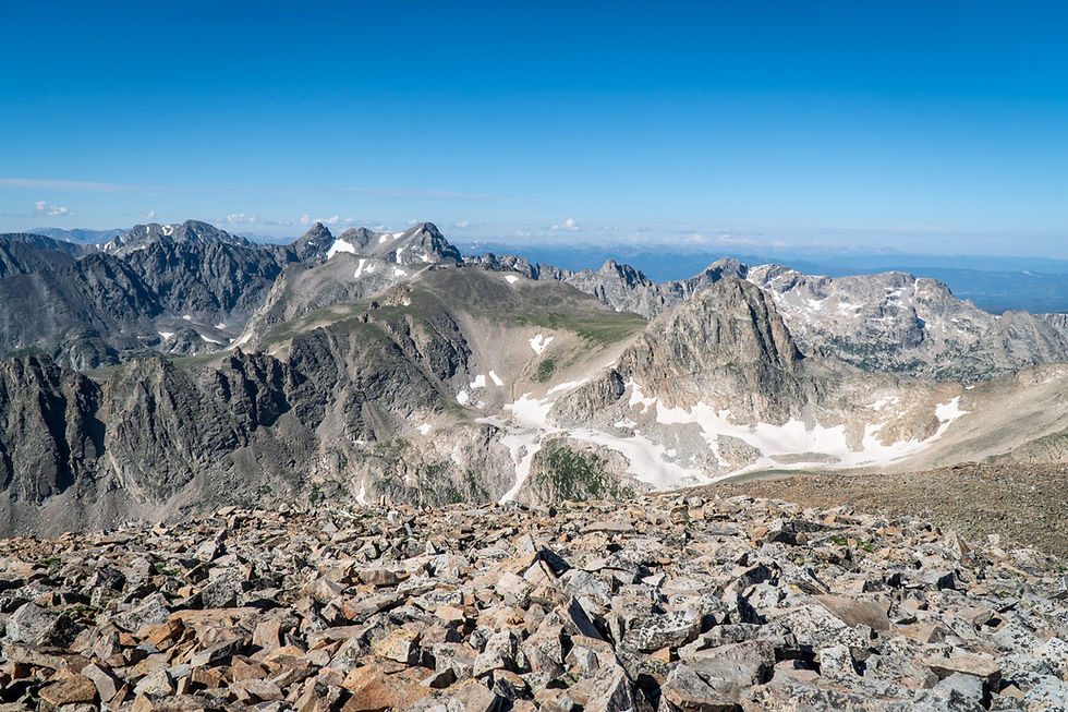
Or this shot gazing west toward a jagged skyline of other Indian Peaks.
It’s possible to turn this into a loop hike that passes Paiute Peak, Blue Lake, and connects with the Mitchell Lake Trail. But be warned, the descent from Paiute is no joke. Loose scree and steep pitches make it a bit of a gamble. I stuck with the classic out-and-back.
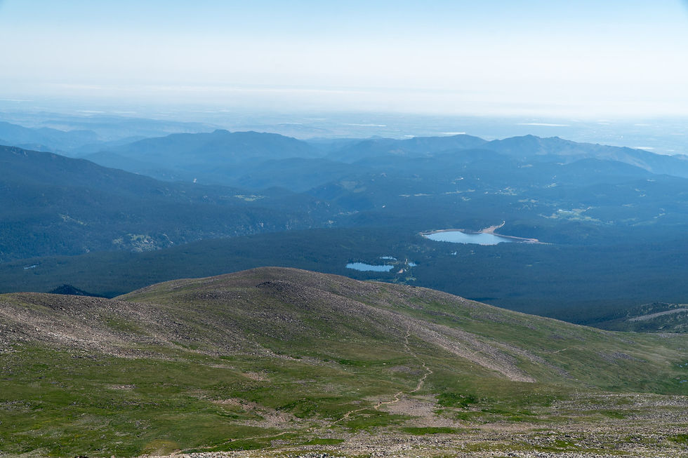
Now comes the reward: that peaceful descent above treeline, soaking in views you missed on the way up.
SS Reflections
I’d always heard Brainard Lake was beautiful. And yeah, I usually grumble about entrance fees. But this one was worth it. With the timed reservation system, crowds were limited, and I got plenty of solo trail time. Like most things in life, it’s a tradeoff. For me, it was a $2 well spent.
Other helpful resources
Handstands around the world's post about this hike


