
Mount Tauhara: Steep and Satisfying Hike Near Taupō, NZ
- Jul 29, 2025
- 3 min read
While the Taupō area is better known for sights like Huka Falls, geothermal wonders, and the volcanic terrain of nearby Tongariro, the Mount Tauhara Track is a lesser-known gem. If you've been cooped up in a car too long, this steep but rewarding trail offers a perfect leg stretcher, with panoramic views of Lake Taupō and beyond.
Trail Info
Trailhead Name | Tauhara Track |
Distance | 4.2 miles / 6.8 km (out and back) |
Estimated time | 2-3 hours |
Elevation gain | 1,700 ft / 500 m |
Highest point | 3,570 ft / 1,088 m (Mount Tauhara) |
Permits / fees | None |
Parking | Paved |
Toilets? | No |
Dog friendly? | No (prohibited) |
Know before you go
Expect to encounter cows or other livestock at the beginning as you'll be walking through an operational farm. Traversing the farm is allowed, just watch your step (the cows leave "gifts")
Don't be alarmed if you hear some gunshots as there is a shooting range nearby. Don't worry, everything is well set up so you won't be hit by a stray.
The trail can be rocky and rooty. Once in the forest, the climb becomes quite steep and demanding. Get ready for #legday
Other activities nearby
While Mount Tauhara is a steep and satisfying hike, many of Taupō’s other outdoor attractions offer a more relaxed vibe.
Huka Falls – A quick stop with short walking paths and dramatic views of powerful rushing water through a narrow gorge. It's one of the most accessible and popular natural sights in the country.
Craters of the Moon – An easy boardwalk loop through a bubbling geothermal landscape. A low-effort way to experience Taupō's volcanic personality.
The Trail

After parking, begin along the obvious trail. Say hi to your cow friends (from a respectful distance).
While walking through the farm felt a bit odd at first, it had its own charm. The lush green pastureland is surprisingly picturesque.
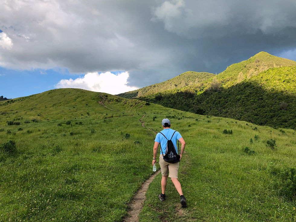
As the trail nears the forest, the intensity picks up. The high ridge visible to the right marks the summit destination.
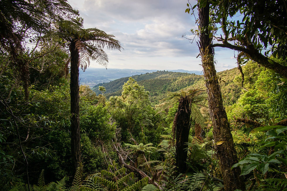
And so begins the forest scramble. Not gonna lie, this section is tough. The trail is eroded and steep, and you'll probably need your hands to help you climb up the root-laced path. Still, it’s a peaceful forest escape that rewards the effort.
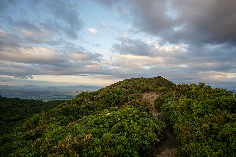
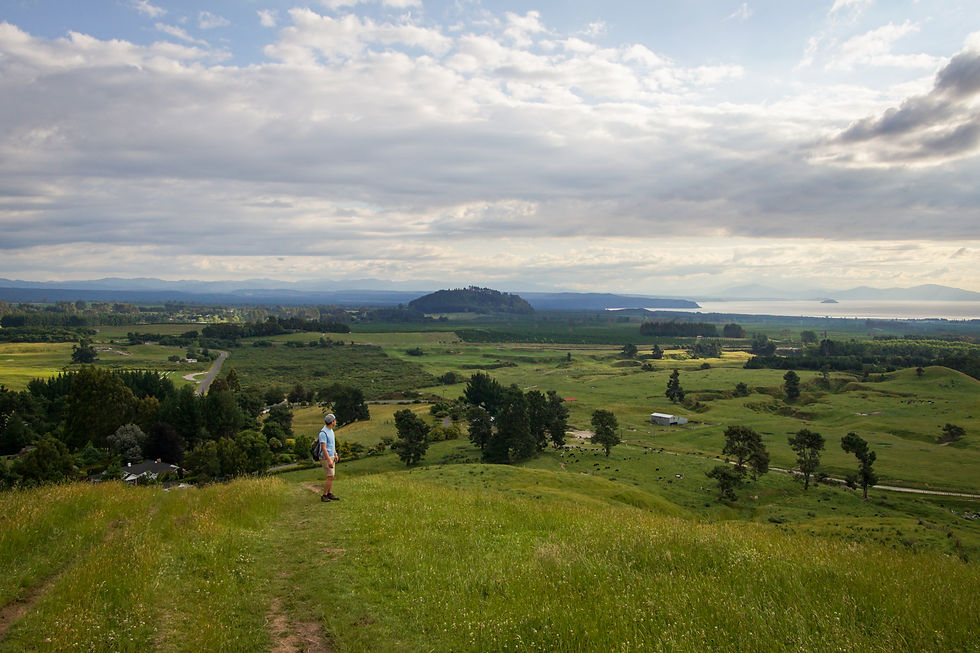
The grade begins to level out as you break through the tree line. But don't be fooled, the main summit lookout requires a sharp hairpin turn to the right, back toward the lake.
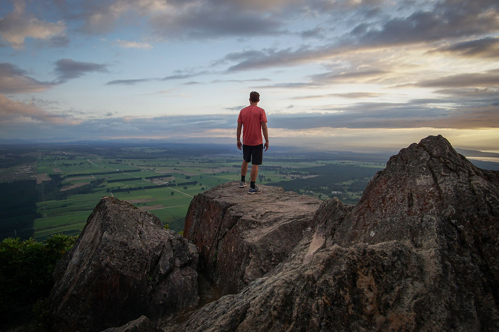
It’s worth those final steps. A series of rocky outcrops offers a perfect photo op, with sweeping views of the flat farmland and glittering lake below.
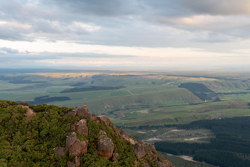
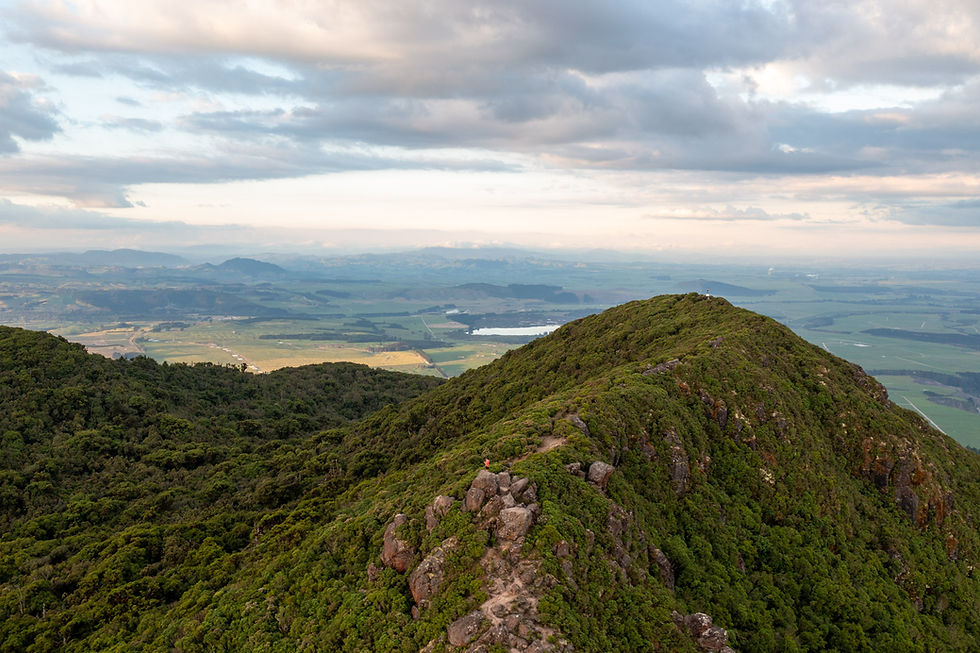
And the view only gets better from the air. The contrast between rolling hills and open grassland is stunning.
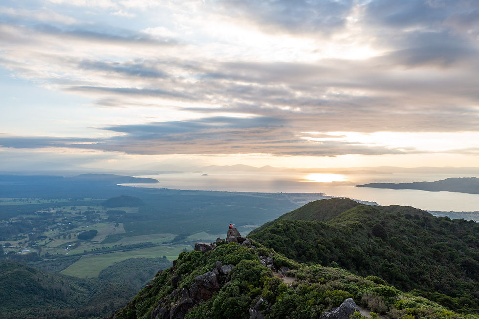
One more drone shot for good measure with Lake Taupō shining in the distance.
SS Reflections
New Zealand’s North Island is known for its geothermal and volcanic landscapes, most famously, the Tongariro Alpine Crossing. But with an afternoon to spare, my travel companion Pete and I tackled the Mount Tauhara Track near our accommodation for the night.
It was a lovely little leg burner that gave me a fresh perspective on the North Island’s diversity. Just a short drive from here we’d be trekking through dramatic volcanic terrain the next day, yet this quiet summit offered a gentler, but no less rewarding, side of New Zealand’s landscape.
Other helpful resources
This writeup of the Tauhara track


